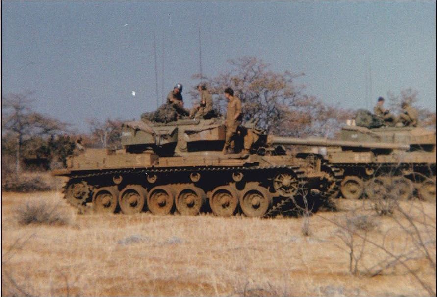
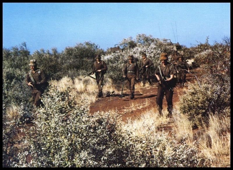
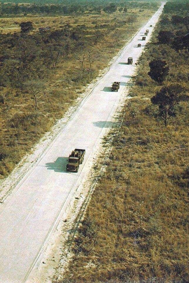
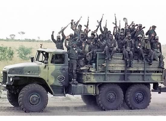
The sparsely populated African bush was both the backdrop for the South African Border War and the geography that shaped the development of the SADF war fighting doctrine and the design of the vehicles that they used to execute it. Their wheeled vehicles that formed the flying column of operation Savannah and many of the later cross border operations of the war had a profound effect on modern doctrine, force structues and vehicle design that now underpins the operating concepts of a variety of wheeled formations fielded by a number of the worlds major powers including the US and China.
Represening both the visual and military impact of the African bush is a key component to gaming this Cold War conflict effectivly. In many respects it is the impact of terrain and environment on the conflict that marks it apart from the Central Front in Europe. With that in mind I set out to generate a view of what terrain components I would need to represent and recreate this unforgiving environment effectively on the table top.

The key elements seem to be:
- A lack of roads and tracks
- The flatness of the terrain
- The impact on both visibility and manoeuvre of the shrubs and trees that comprised the bush
- The seasonality which drove both the operational cycle and the look of the terrain from dry arid to wet green, lush and boggy.
- The limited settlement and impact of man
The ground overwhich the conflict was fought sits within the tropics and the environment can broadly be categorised as tropical savanna. When you use that word it tends to conjour up a view of rolling grass land but it actual covers a variety of eco systems ranging from open grass land to dense woodland and just about everything in between. Unlike central europe the dominant driver in Africas sparsley populated open spaces is less likely to be man and more likly to be fire, the local geology the season and the grazing population.

Wikipedias entry on tropical and sub tropical grasslands provides links through to a range of eco systems that sit within this area and searching against a range of the terms will lead to an appropriate set of picuters being delivered. Equally study of the terrain in the background to the images of the war is also useful as well as looking at what the modern tourist uploads to google earth.
I believe their are a number of features worth including for the table top representation of these environments both for their impact on the game and to set the context for conflict in Namibia and Angola these are:
- Low bush
- High bush
- Shonnas
- Roads
- Waterholes
- Rivers
- Bridges
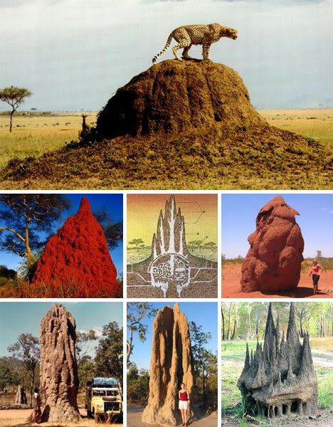
- Termite Mounds
- Krals
- Koppie
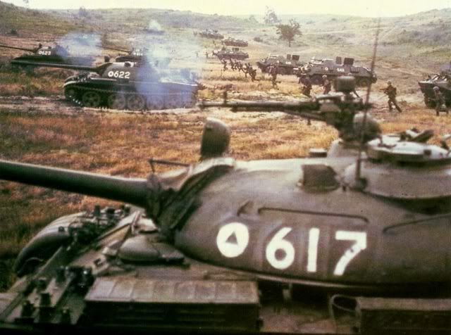
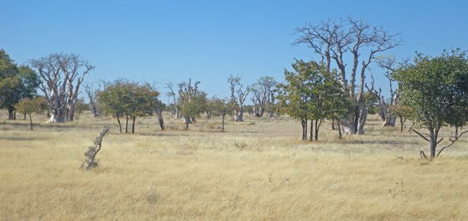
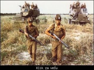
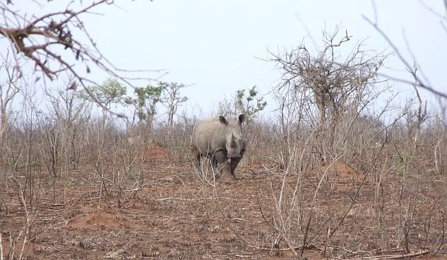
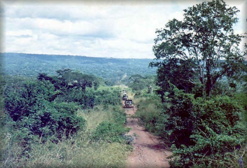
low Bush - Within the immages and the deffininitions of tropical savannah you end up with a variety of vegitation patterns that will affect game play. The grasses seen in the picture above and in the bottom of the two below may provide concealment in the prone position. Whilst the low bush which contains a variety of scruby and often thorny 4" to 6" plants will affect visibility and can conceal both standing figures and smaller vehicles such as Elands and T-54/55. Higher vehicles, Ratels Buffels and Caspirs would be less affected.
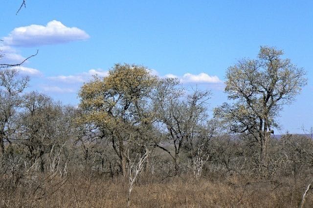
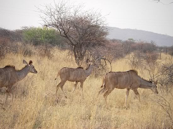
High Bush - For my terrain definitions high bush starts to introduce trees these can be sparsly scattered amoungs low bush where the imact is marginal other than astheic. As the density increases they should affect visibility and manoeuvre, at the upper end they become woodland. Prior to becoming a wood their impact could be to impose a maximum engagement range and speed, which would reflect the fact that you need to work your way through them even in armoured vehicles. Regaurdless of season their always seems to be quite a high degree of dead material which would also need representation.

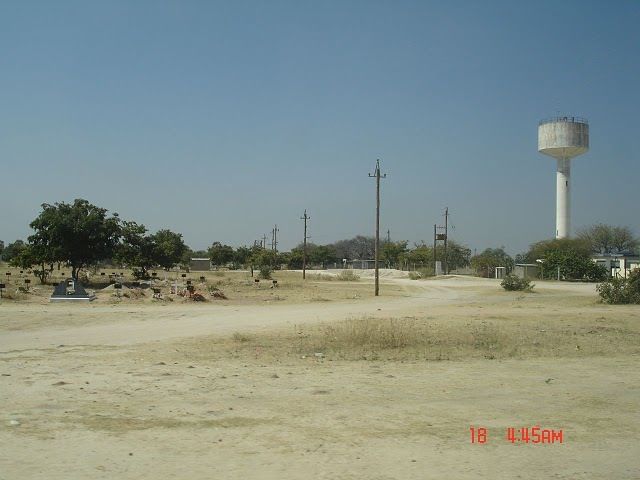
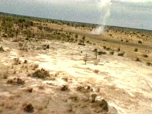
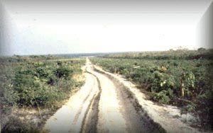
Shonnas - I could find no formal definition of Shonnas they are described in a number of texts as open areas, which I have assumed were free of Bush cover, the two pictures below illustrate what this might look like. They also seemed to be associated with soft sand and boggy ground around rivers and streams so could come with game effects around probability of bogging in.
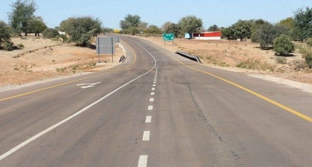
Roads - what passes as a road in the African bush can cover a variety of options from vehicle trafficed unmade tracks through to more familiar tarmaced roads. from a review of maps and immages they do seem to have a tendancy to run straight probably due to limited obsticles to dodge.

Waterholes - these dont really affect the action but can break up an otherwise uniform terrain and provide some African context. Having said that you'd rather expect the grazing population to "do one" as soon as the shooting started.

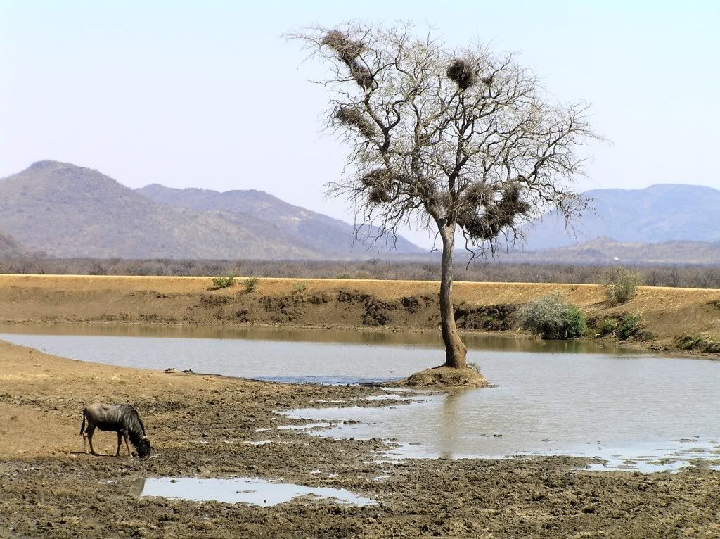
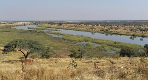
Rivers and Streams Were generally few and far between in the operational area, but dominated manoeuvre in the battles fought in the clossing stages of the War around Cuito Cuineval around which the action of Operations Modular and Hooper played out. They could play a significant role in shaping both manouver and the contact points between the forces due to the limited crossing points and this is born out in a number of texts on the war. Significant areas of reduced mobility including boggy and flooded ground could extend the crossing problems particularly in the wet season.
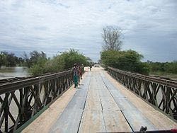
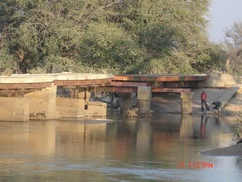
Bridges - Bridges are bridges the world over but for my African games I think I am looking for a couple of types. The Ex military Baily bridge and the simple concrete or wooden bridge are both fairly evocative of the third world.
Termite Mounds - One of the few tactical significant insects is the termite, the mounds are large, can provide cover and in a broadly flat terrain offer a vantage point for dismounted troops, they are mentioned in a number of texts and seem worthy of representation. Not sure whether the ocupants object to people standing on their homes or indeed shooting them up.
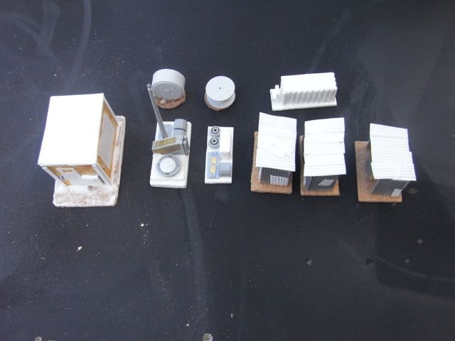
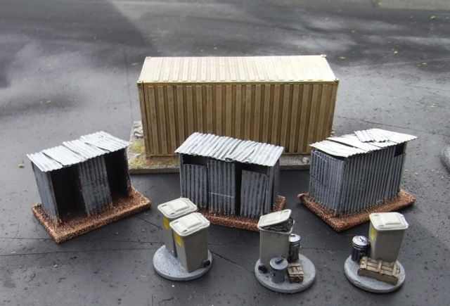
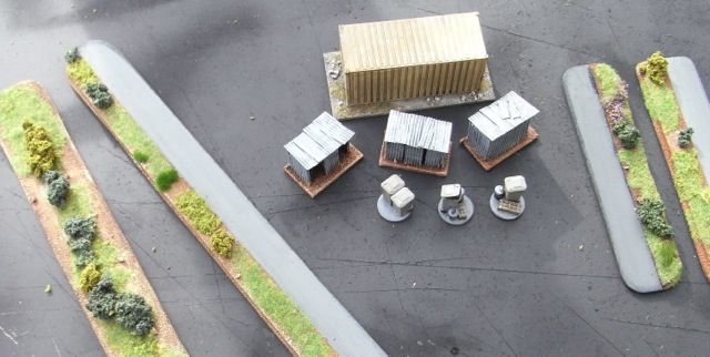
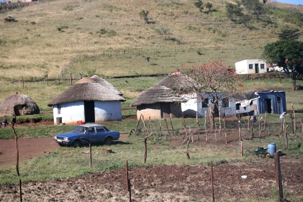
krals - are traditional small scale settlements scattered around the area. They incorperated a degree of protection for a family group or indeed small group of families. As with all things in the modern age these could be of all traditional construction or mixing traditional building methods with more modern materials. Equally the lifestyles of the occupants could be traditonal or mixed. In gameing terms these can represent an activity focus for patrols or just form part of the more general terrain.

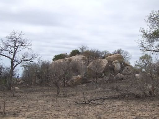
Koppie - an isolated rock outcrop or small hill common on the affrican veldt less common in the Southern Angolan operational area from most of the literature I have consumed to date. They always struck me as an interesting idea for a terrain feature.
Clearly a variety of terrain types were fought over and a range of terain components are needed to create a representation on the table top to represent the environments and ground that was fought over.
Topographic Maps, oddly enough as the Border war was fought at the back end of the Cold War both the US and the Soviets developed fairly extensive mapping of the area. The maps are available to download free or at low cost on line. Mapstore one of the pay to download services offers an excellent preview capability which might be good enough and is very easy to navigate to specific locations if you have a rough idea of where they are. Examination of this data can give you a good general feel for the topography either generally or for specific battle sites.
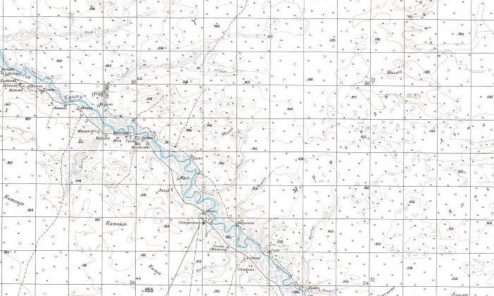
The Soviet Maps take a little more effort to work out where you are but once you have cracked that their 1:200,000 Maps have quite a reasonable level of detail, a quick purusal is enough to understand, its flat, the road/track network is sparce and major rivers are a potential problem.
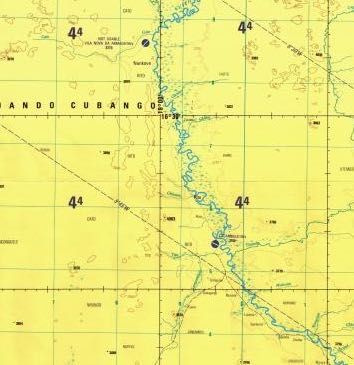
The US Maps are a little easier to use however at 1:250,000 the coverage is less good and they are a 1973 survey as opposed to a 1980 survey, not that I suspect a lot changed in the bush in 7 years. Both the US and Soviet Map sets can be found and downloaded I find the pay to use sites are slightly better organised and easier to find and use. The charges are relativly low with individual sheets for $1, whole sets tend to come in at $10-$15. Soviet Map coverage of the central front from the same source is also very good.
I must add that I have never been to any of these place and that my experience of them has been derived from reading, reviewing immages and looking at maps. If any with more physical experience of environment have views on what aspects of the bush impacted the fighting and should be represented in a gameing context please feel free to contribute. The next couple of posts in this series will focus on towns and villages with a look at building styles as well as examening how to build the terrain to acheive the requiered table top effect.
References:I must add that I have never been to any of these place and that my experience of them has been derived from reading, reviewing immages and looking at maps. If any with more physical experience of environment have views on what aspects of the bush impacted the fighting and should be represented in a gameing context please feel free to contribute. The next couple of posts in this series will focus on towns and villages with a look at building styles as well as examening how to build the terrain to acheive the requiered table top effect.
On Line:
Mapstore Topographic Maps of Angola
Blueplanet Biomes
BBC Savvana Grasslands
Wikkipedia Sub Tropical Savvana
Angolan Moepane Woodland
Books:
The SADF Border War 1966-1989, L Scholtz